I’ve mentioned in some other posts that the Covid pandemic ruined an amazing trip Jarrett and I had planned. If you didn’t read the other posts (c’mon on, go back and read ‘em!), we were planning to go to Sequoia, Kings Canyon and Yosemite National Parks and then head up to the Lake Tahoe area for a few days. I was dead set on going to Yosemite National Park in the spring because I wanted to see all the waterfalls in their raging glory. We felt spring 2021 was still too questionable since Covid vaccines were just rolling out and we didn’t want to risk booking a trip before we were vaccinated. But in May 2022 we were finally ready to make it happen!
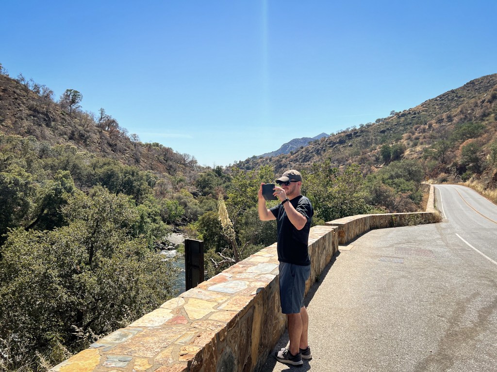
Our trip had us flying out of Boston, Massachusetts on a Tuesday and returning 10 days later, on a Thursday. We got an early flight out of Boston and into Fresno, California. We picked up our rental car and our first stop was a Vons grocery store to pick up all our favorite road trip and hiking snacks, sandwich materials, lots of water and other supplies. The drive from Fresno to Three Rivers was interesting. It felt like we were just driving forever through a grid of farms – I think maybe citrus farms, but don’t quote me on that. When we arrived to Three Rivers, we drove straight into Sequoia National Park through the Ash Mountain Entrance. I knew the weather would be warm when we arrived but it was around 90º F, which I was NOT expecting!

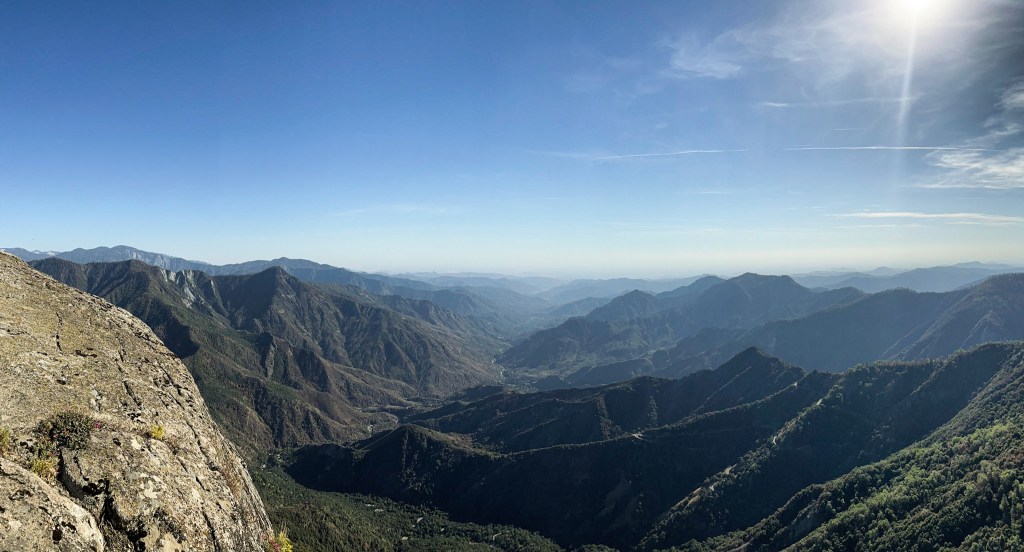
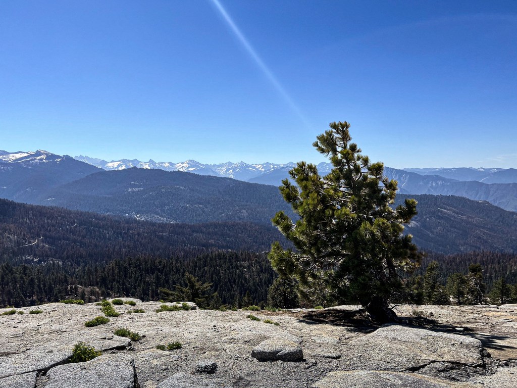
We drove up Kings Highway, the winding, narrow road through the park. I couldn’t believe the elevation gain we got so quickly. We were driving, getting higher and higher in elevation when all of a sudden Jarrett was like “Oh my God Suze, look!” So I started looking around for an animal or something like that, but then I realized he was looking at the massive Sequoia tree that was coming up on the left side of the road. This would be the first of many we saw but we were both speechless by it’s size.
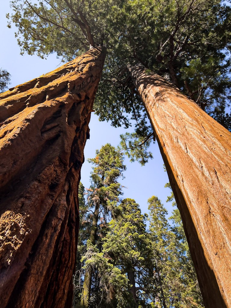
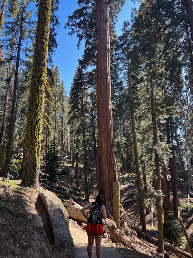
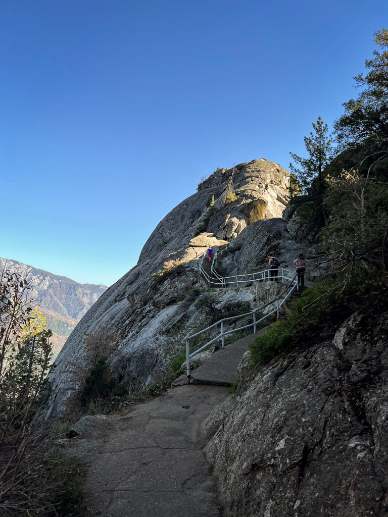
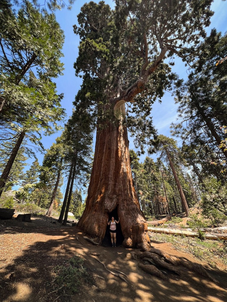
Our first stop was the General Sherman tree and the Congress Trail. There was a line to take pictures with General Sherman but everyone was helpful taking pictures of each other. We just couldn’t get over the size of the trees, it was really such an incredible experience realizing how small we are compared to them. After spending time wandering amongst the trees, we headed over to Moro Rock, which is a very short, but steep trail, with about 350 stone steps. It was a beautiful hike with 360º views. To one side we had the snow capped Sierra Mountain range and to the other was the green of the valley. It reminded me of a more tame version of Angel’s Landing at Zion National Park.
There wasn’t much around in terms of dinner options so after driving back down through the park into Three Rivers, we stopped at Totem Market for food. They were getting ready to close but were so nice, letting us order sandwiches and beers to eat while they worked on cleaning up for closing. It’s completely random but I had such a good chicken wrap there, it might have been my favorite thing I ate all vacation! We stayed at a cute little cabin nearby called The Sequoia Hut. There was a larger main house being rented by another party and then we had the smaller one room hut on the property. It was the perfect spot for us to stay. We passed out immediately. I think we went to bed before 8pm almost every night of vacation!
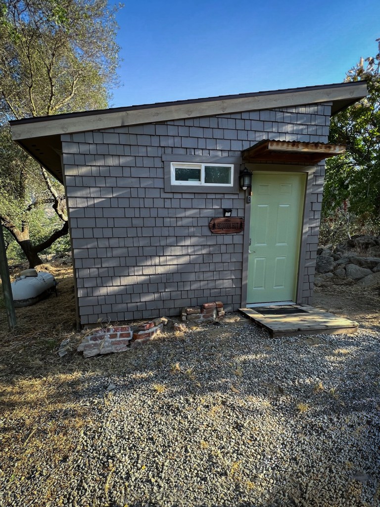
2. Our cute cabin, The Sequoia Hut
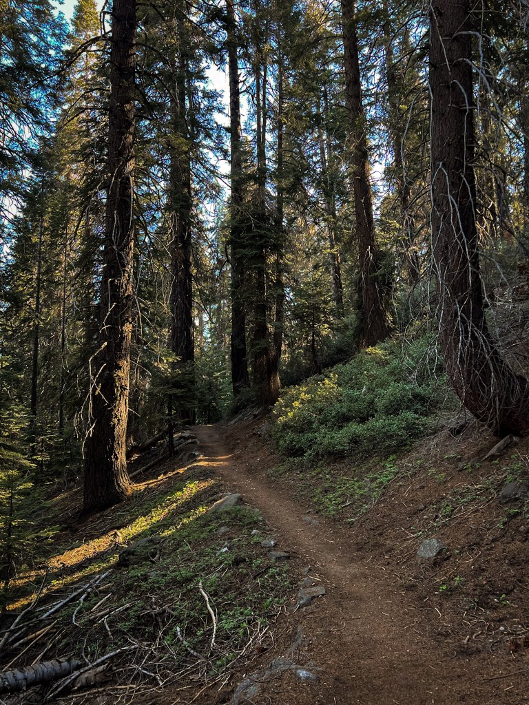
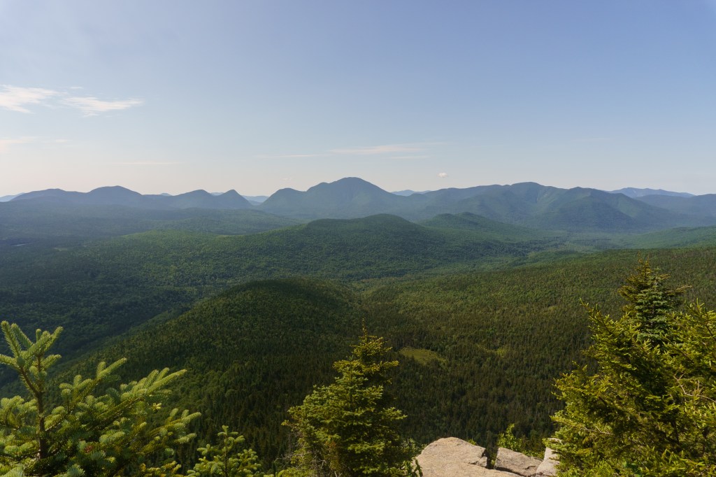
Our second day started off with an hour drive back through the park to the Little Baldy trailhead. The Little Baldy hike was really pleasant. It was quiet, not too challenging and not crowded at all – we only saw a handful of people. The trail was well marked and maintained.
When we got to the summit, we had the whole place to ourselves! We spent some time there eating snacks and watching lizards scurry around. During the hike we kept hearing a strange noise reverberating through the forest. We were trying to figure out what it was but it wasn’t until a few days and some research later that we found out it was a sooty grouse. We thought it was an elk or something – shows how much we know! We also saw a few cute marmots running around during the hike!
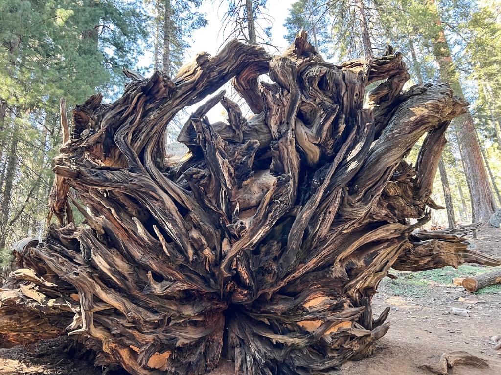
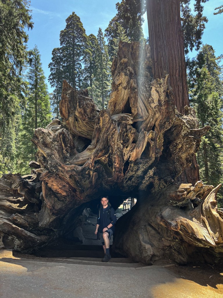
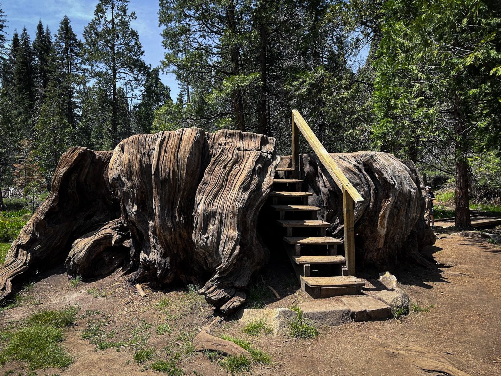
After the hike, we continued on Kings Highway to Kings Canyon National Park. We went to General Grant Grove to see more of the amazing sequoias. My favorite was the Fallen Monarch that you could walk through – it was incredible. I felt like I was walking through the belly of whale. After, we went to the Big Stump trail. It wasn’t the most well maintained and looked like there was some work being done on it, however, I’m glad we did the hike. It was sad to see all the sequoias that had been cut down but it further showed how massive the trees can get. The finale of the trail was the Mark Twain stump, which had stairs built in so you could actually walk on top of it. We didn’t spend too much time at Kings as we had a few hours drive ahead of us but I’m glad we got to experience some of the park. On our way to our next hotel in El Portal, we made a pit stop back in Fresno for gas and to restock our water supplies as we knew we’d have limited options near Yosemite.
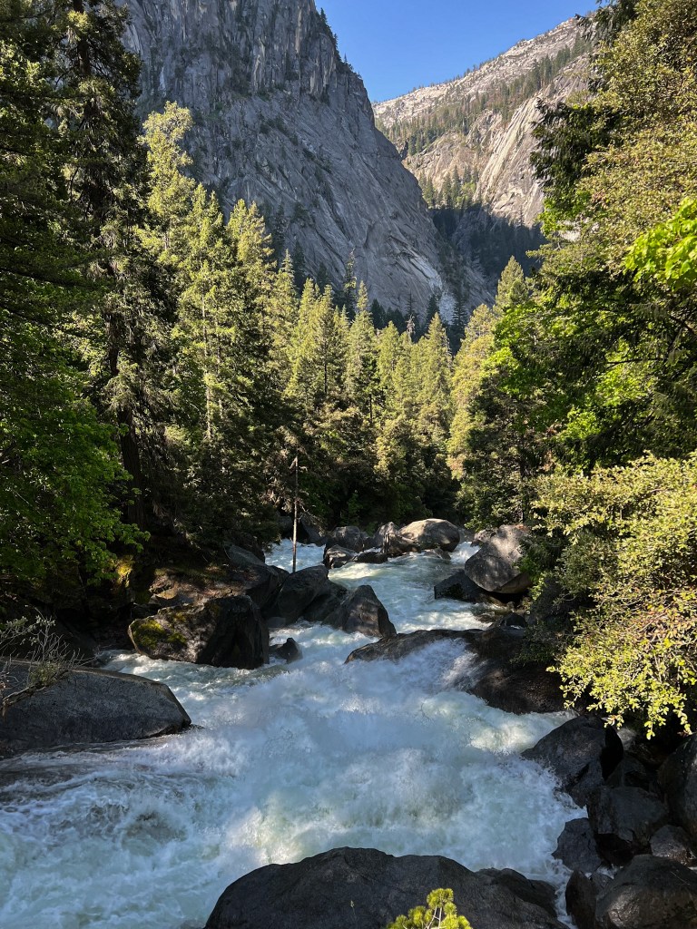
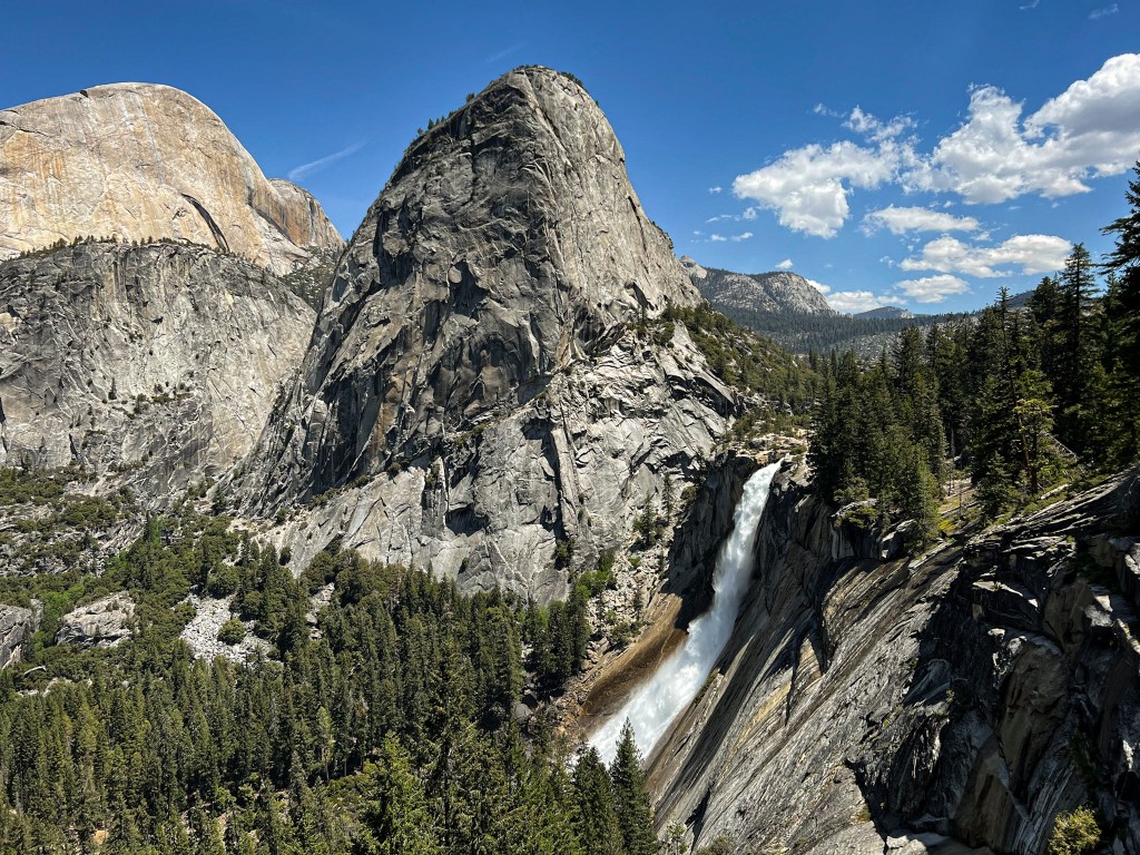
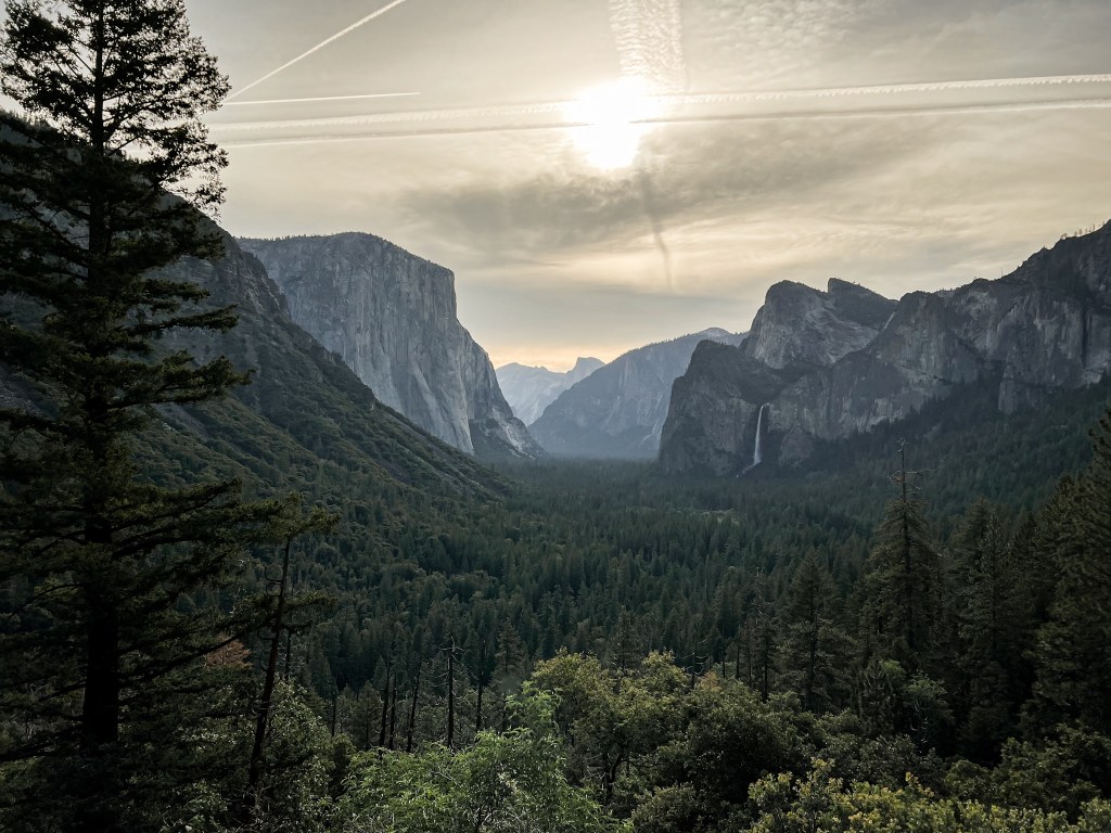
Thursday morning we headed into Yosemite. It was just as incredible as I hoped it would be. It was also just as crowded. We parked at Curry Village and hopped on the shuttle to the start of the Mist Trail. Our goal for the day was to hike up to Vernal Falls and then continue up to Nevada Falls. It’d be a long hike but we were prepared with snacks and plenty of water.
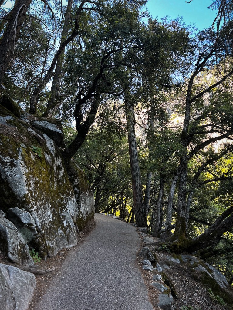
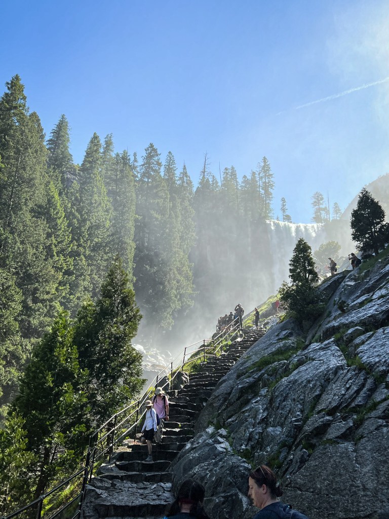
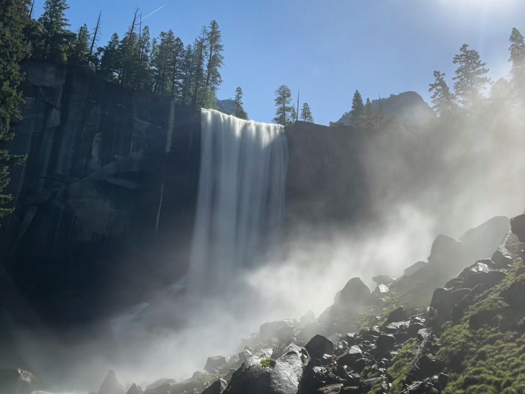
The first part of the trail was paved. It was also really crowded and there were a ton of other tourists. Once you got closer to the falls, you could feel the cool mist in the air. Vernal Falls was incredibly powerful in the spring and we got soaked walking up the stone steps of the trail. Luckily the day we went it was hot out, so while we were a little chilly after being wet from the falls, we dried off quickly.
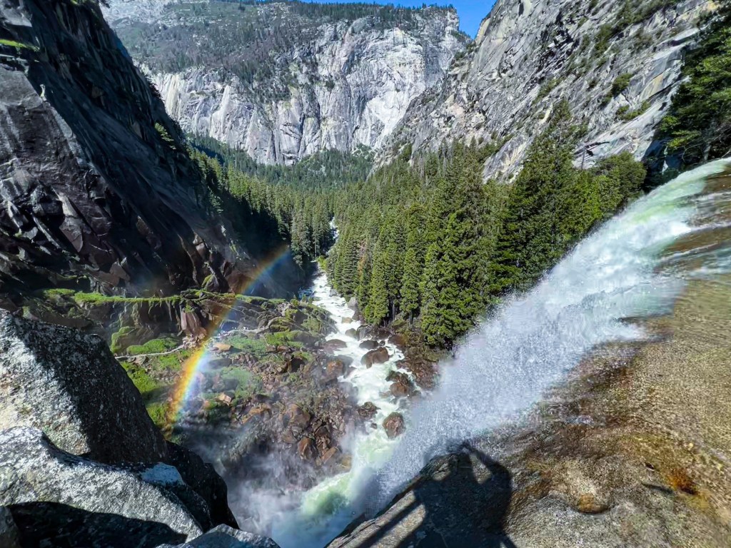
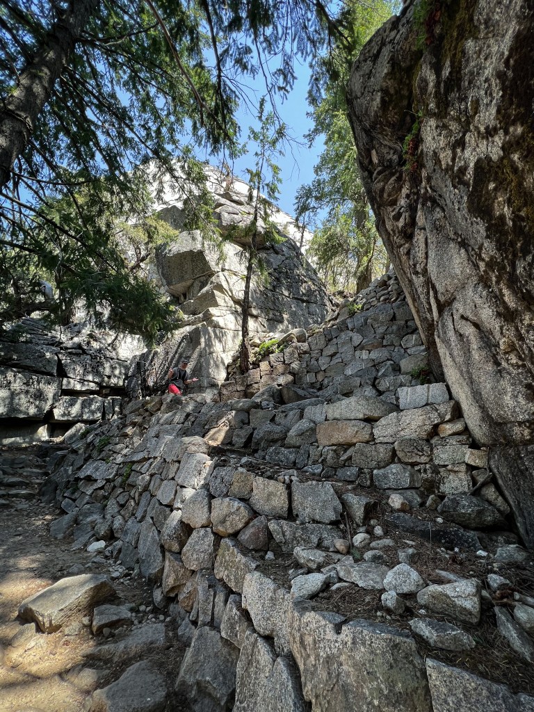
After the stone steps there was another steep climb to the top of the falls. Here we had a beautiful overlook of the falls, the stone steps we just climbed and the rest of the valley below. A lot of people were lounging here and eating snacks. The gray squirrels were very aggressive here and trying to steal food, so beware. Once we passed this area, the amount of people on the trail thinned. Far less people continued up to Nevada falls, which was nice. We meandered through the woods for a bit alongside the river, which was lovely. However, we soon hit a large section of stone switchbacks that were grueling.
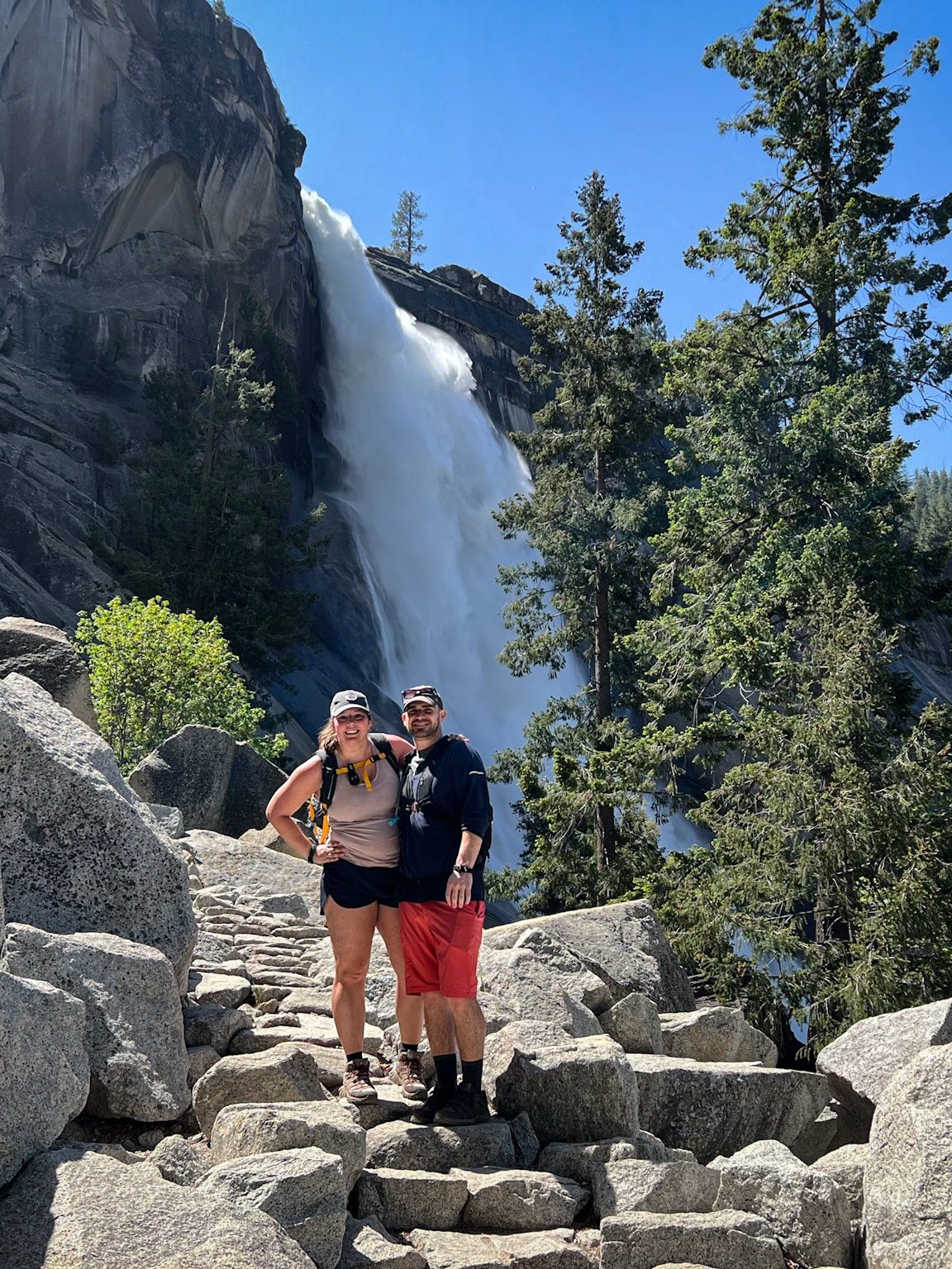
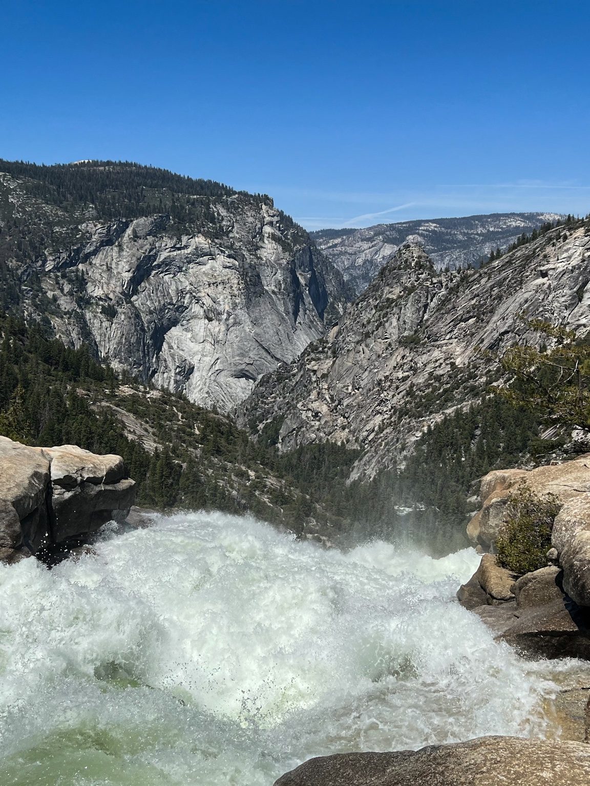
When we finally reached the summit of Nevada falls, we were ready for a break. The river had a small beach-like section so Jarrett and I joined some other hikers by taking off our boots and soaking our sore feet in the frigid mountain water. Before we started our descent, I soaked my baseball hat too to keep me cool. The views from Nevada Falls were incredible and I took about 1,000 pictures of the same view from slightly different angles. By the time we reached the trailhead, hopped on the shuttle and got back to the car, it was 2pm. We devoured the sandwiches we packed and decided we’d go to Mirror Lake but it wasn’t that exciting. There were a lot of people swimming though. Curry Village, where we parked, had a bar so we got some local beers and a pizza there. We were both exhausted but content – we headed back to our hotel and called it a night.
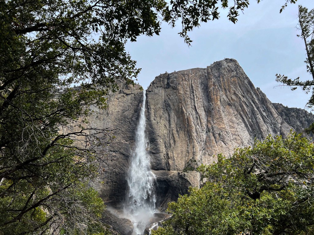
The next day we didn’t have an exact plan but wanted to get to the park even earlier than the day prior. We went to Tunnel View first to get some pictures there in the morning light and decided we’d return later in the day to see what it looked like in the afternoon. I had originally planned for us to do the Yosemite Falls hike but I had gotten some pretty bad thigh chaffage the day before (sorry if TMI, but ya know, it happens!) and wasn’t sure if I’d be able to handle the full hike. We parked near the trailhead just in case but decided to meander around to start.
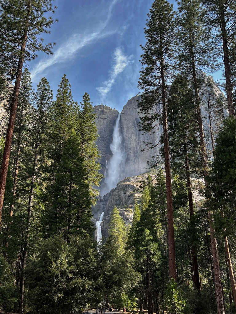
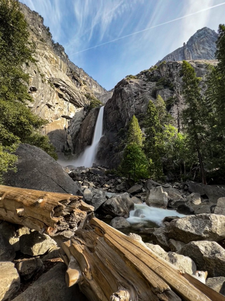
We started our day with the Sentinel and Cook Meadow Loop which was easy but beautiful. We lingered along the trail by Lower Yosemite Falls, saw lots of Stellar’s Jays and some casual deer strolling around. Once we completed the loop, we went to one of the cafeterias for breakfast. After filling our bellies we decided we’d start the hike to Yosemite Falls and if we needed to turn around we could. I couldn’t believe the number of people we saw on the trail who were completely unprepared. The beginning of the trail wasn’t that dangerous or anything, but there were a lot of large rocks and the trail was sand on top of stone so if you didn’t have good grippy shoes, you could easily slip. We saw people in flip flops, Crocs and Keds sliding all over the trail. We also saw a lot of people who didn’t have any water with them – and it was hot out! We made it about half way up the trail to the summit when we both started to run low on water so decided to turn around. We were still able to get some beautiful views, pictures of the falls and were satisfied with the hike, however, the next time I go to Yosemite, I will definitely be doing the whole hike!
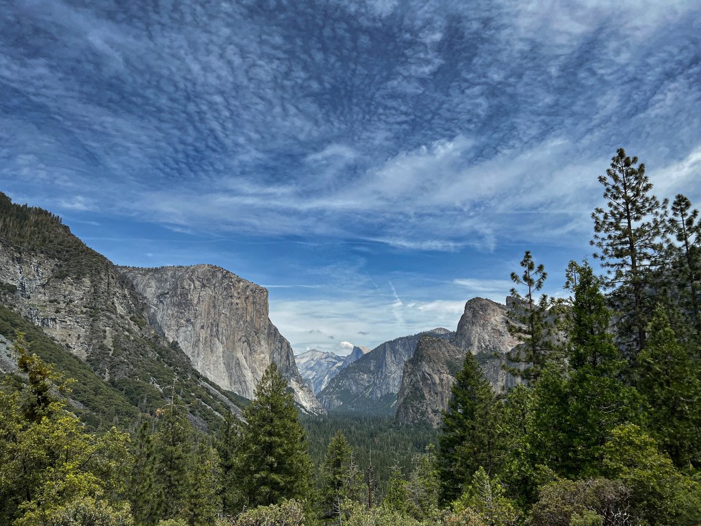
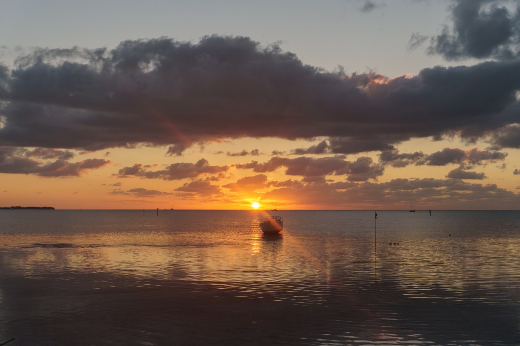
Per our hiking tradition, we wanted to grab a post-hike beer but couldn’t find an open bar within the park near where we had parked. We ended up each getting a can from one of the markets and then drove to Tunnel View. We were able to snag the last parking spot in the overflow parking lot. It was a mad house compared to the morning, with lots of tour busses taking over the parking lots. We drank our beers on a bench and enjoyed the gorgeous view. The colors were spectacular. We were planning to leave Yosemite the next day and wanted to cut through the park on Tioga Road, if it was opened, since the road is closed from about October to late May/early June. Luckily for us, it opened the day before we left so we were able to take the road through the park instead of having to circle all the way around.
The next morning we got on the road early. We dressed in shorts, sandals and a sweatshirt as it was cooler in the morning but past two days had been really warm. We were stupid tourists though and didn’t factor in the elevation gain we’d get during the drive along Tioga Road. All of a sudden we had snowbanks on both sides of the road! It started raining, then began to snow. We kept popping out of the car to take pictures – we probably looked ridiculous standing in 30º F temperatures in shorts and sandals taking pictures, but at least the car was warm! We passed through the east entrance of the park and started our descent to lower elevation and higher temperatures. Our next destination was Lee Vining to see Mono Lake!
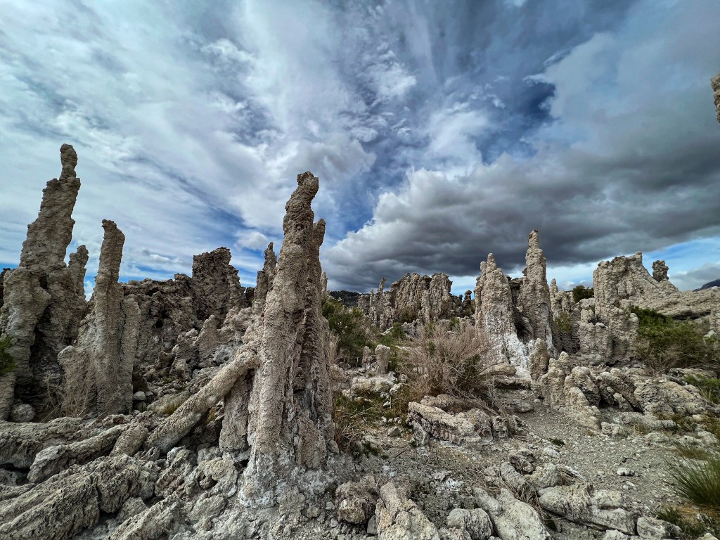
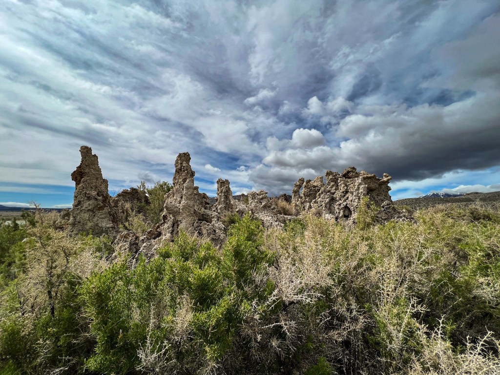
Mono Lake is one of the oldest lakes in North America and is 2.5 times saltier than the ocean! We went to the South Tufa preserve on the south side of the lake. Everything about this stop was just incredible. The beach shrubs and calcium-carbonate tufas along with the clouds made for dramatic pictures. I was on the look out for wild horses but sadly I didn’t see any, only birds. Once we had our fill of wandering along the trail through the tufas, we got back in the car and headed north to our next stop – Bodie State Historic Park.
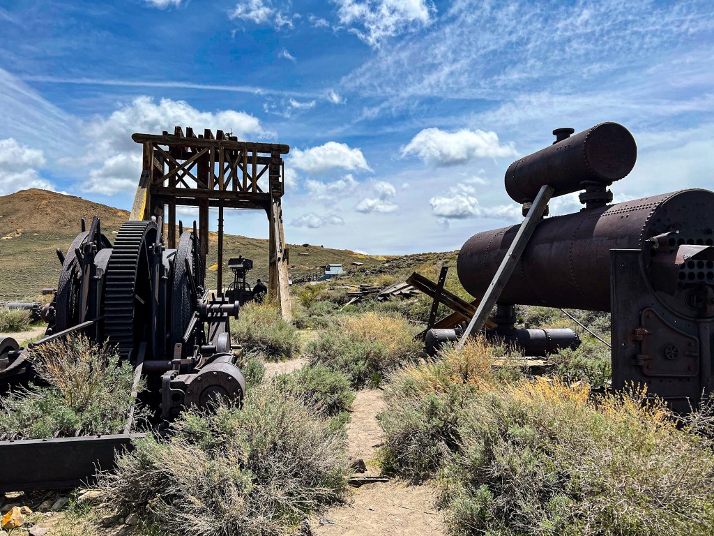
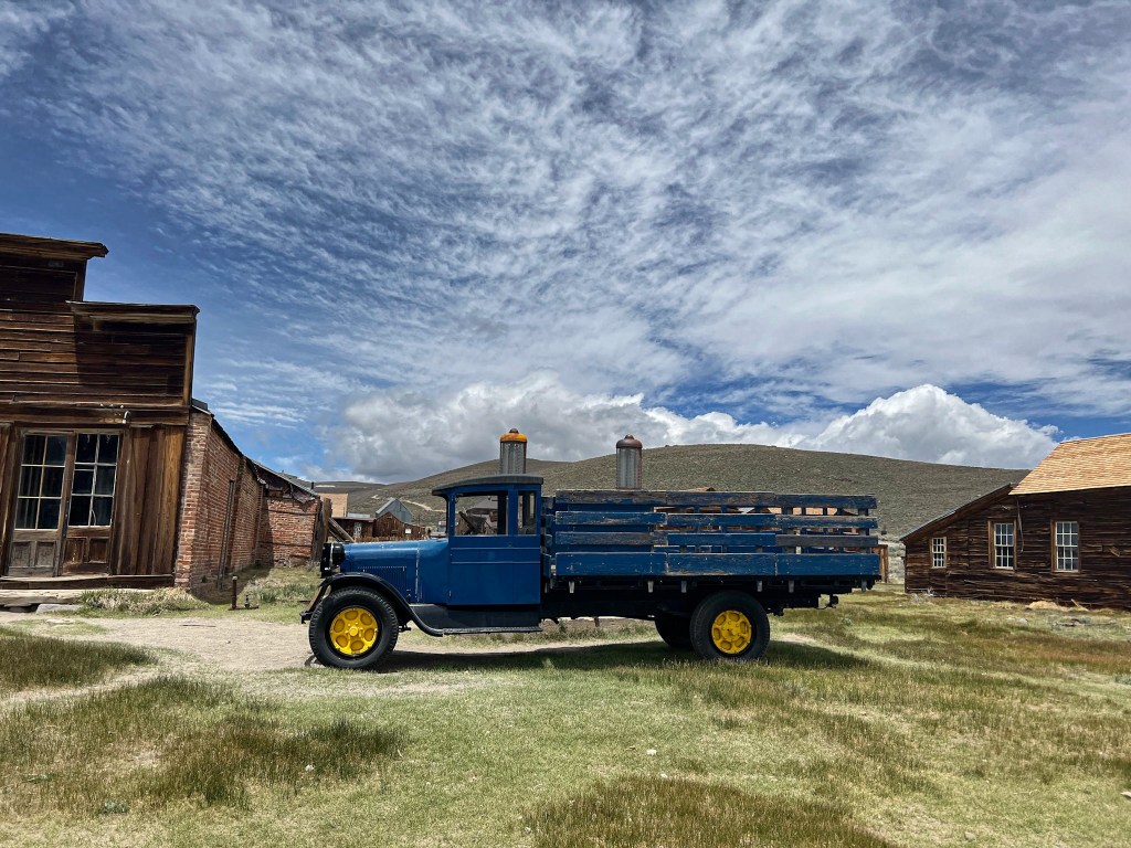
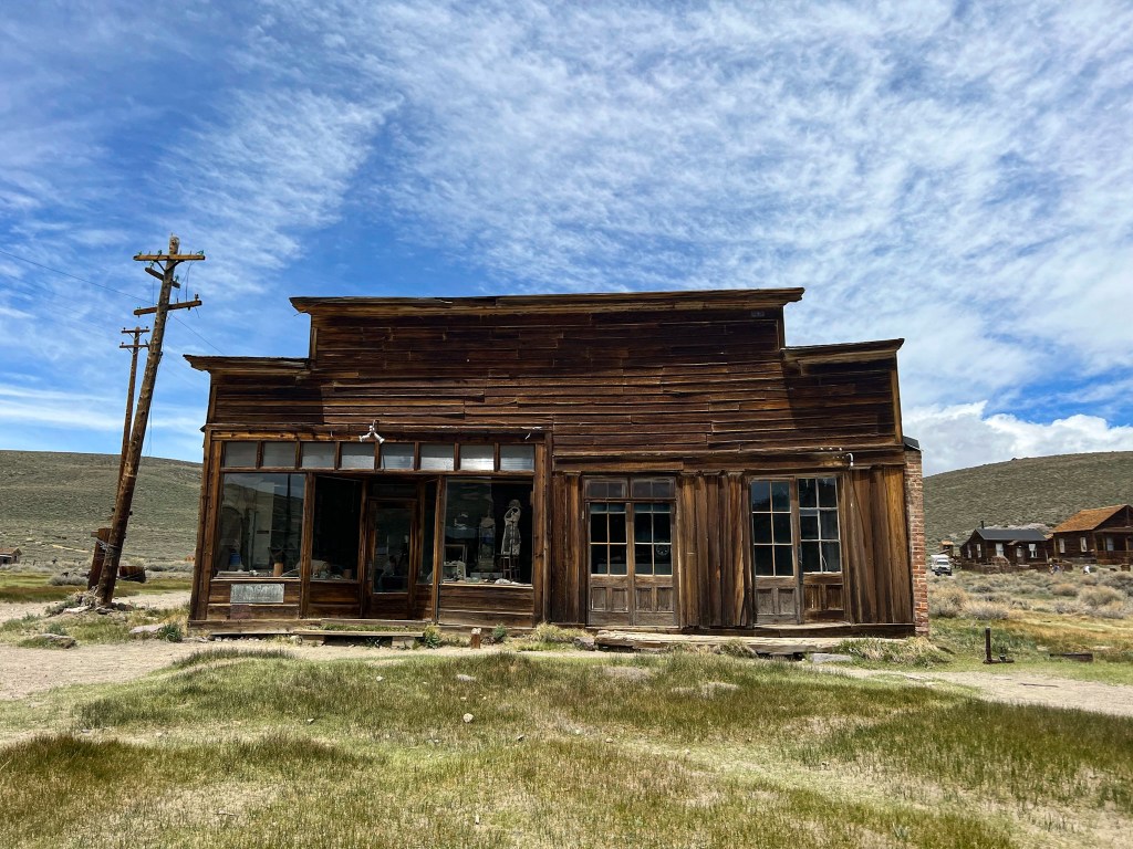
After driving a little further north and down two miles of very bumpy dirt road, we reached Bodie State Historic Park. This a ghost town of a former gold-mining community. There are guided tours but we chose to wander around on our own following along the pamphlet we received entering the park. It was so interesting seeing the history in the town still laid out across the fields. I couldn’t believe that the people had abruptly left the town and left so many belongings behind. If you’re interested in history, I’d definitely recommend making a stop here. We really enjoyed it!

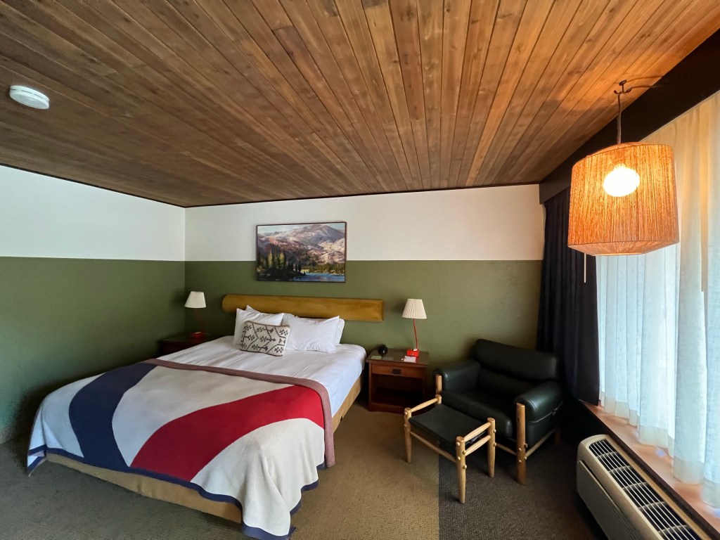
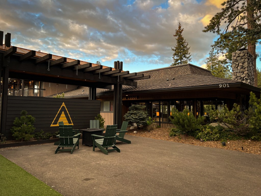
From here, we continued north to the Tahoe area. The GPS took us into Nevada for a bit, climbing through the mountains, back over the border into California and finally into South Tahoe. Our hotel was adorable, I loved it. We were about a block from the lake so we walked down, but unfortunately, everything was gated off and we couldn’t get in without paid beach passes. We were in walking distance of the lively downtown area and stopped by South of North Brewing for some beers, which was a very rowdy place. There was live music, fire pits and games. It’s located in the center of the Basecamp Hotel. We had almost stayed there but changed hotels at the last minute, which I was glad of, since our hotel was much quieter and a few blocks off the main strip.
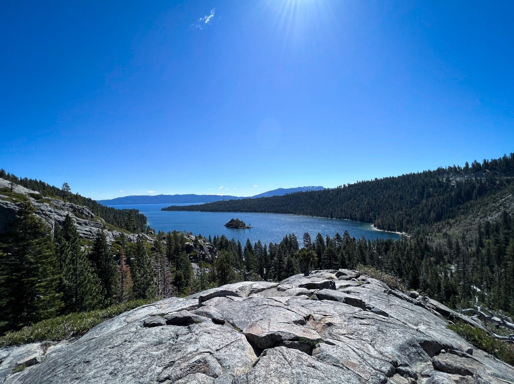
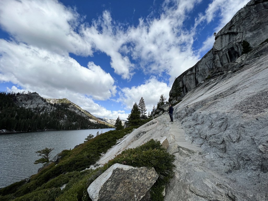
For our first full day in the South Lake Tahoe area, we drove west out to the Eagle Lake trailhead. Our timing was perfect and we were able to snag a parking spot. We got a nice view of Emerald Bay and then started our hike out to Eagle Lake. The trail was pretty crowded at first but the crowds thinned out the further out we went. After reaching the lake and having some snacks, we returned to the trailhead and were overwhelmed by the chaos. In the two hours we were on the trail it seemed like everyone in California had descended upon the parking lot. There were cars parked on both sides of the road as far as about a mile from the trail. Then there was a line of cars in the road, basically blocking traffic, waiting for people to leave so they can grab the next empty spot. We got out of there as safely and quickly as possible.
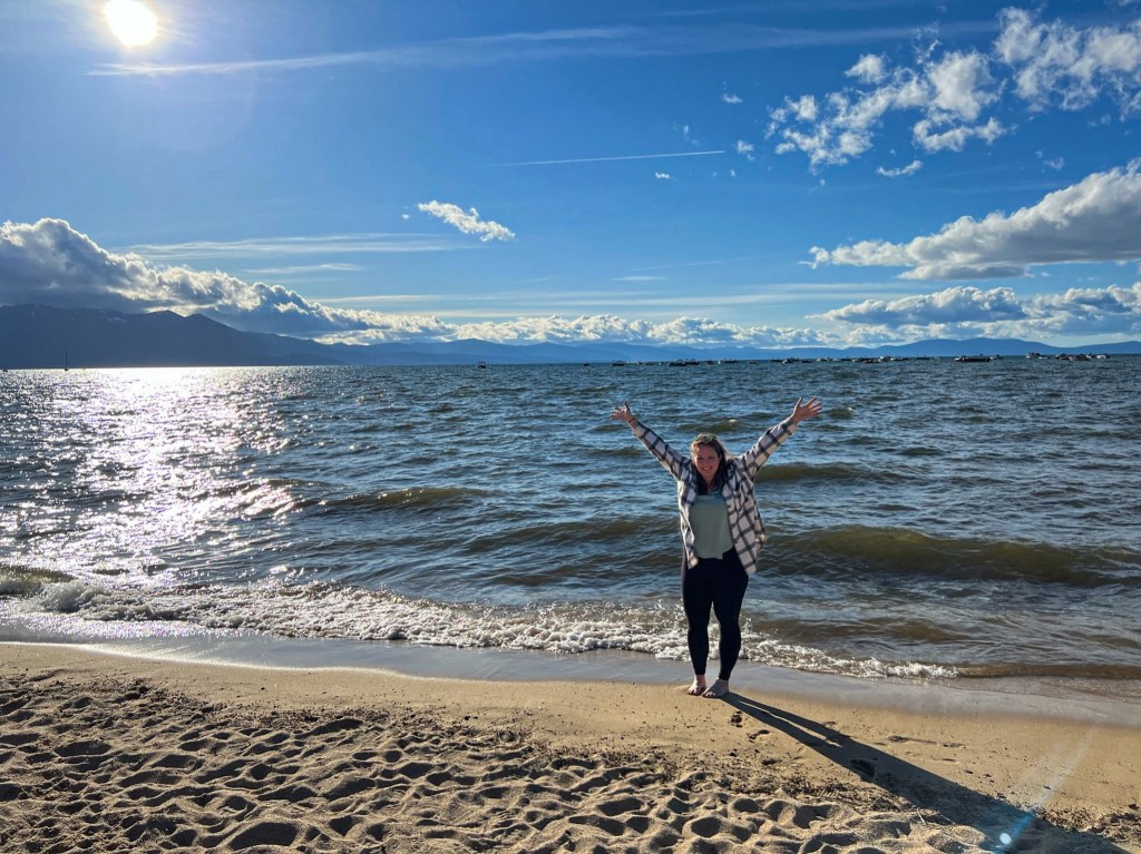
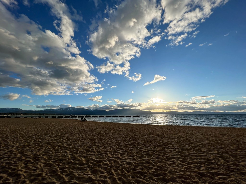
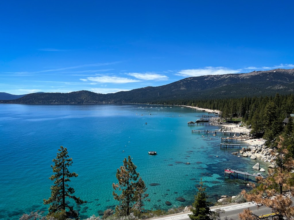
After, we went to South Lake Brewing Co., which we absolutely loved! We sat outside in the sun and chatted with some people sitting near us who were locals. They recommended a trail for us to do the next day, which was really nice of them. We had dinner at a Greek restaurant outside by the lake, but it wasn’t my favorite. After we ate were were able to walk down to the lake and get a better view. I couldn’t believe it was a lake – if I didn’t know better, I’d think it was the ocean!
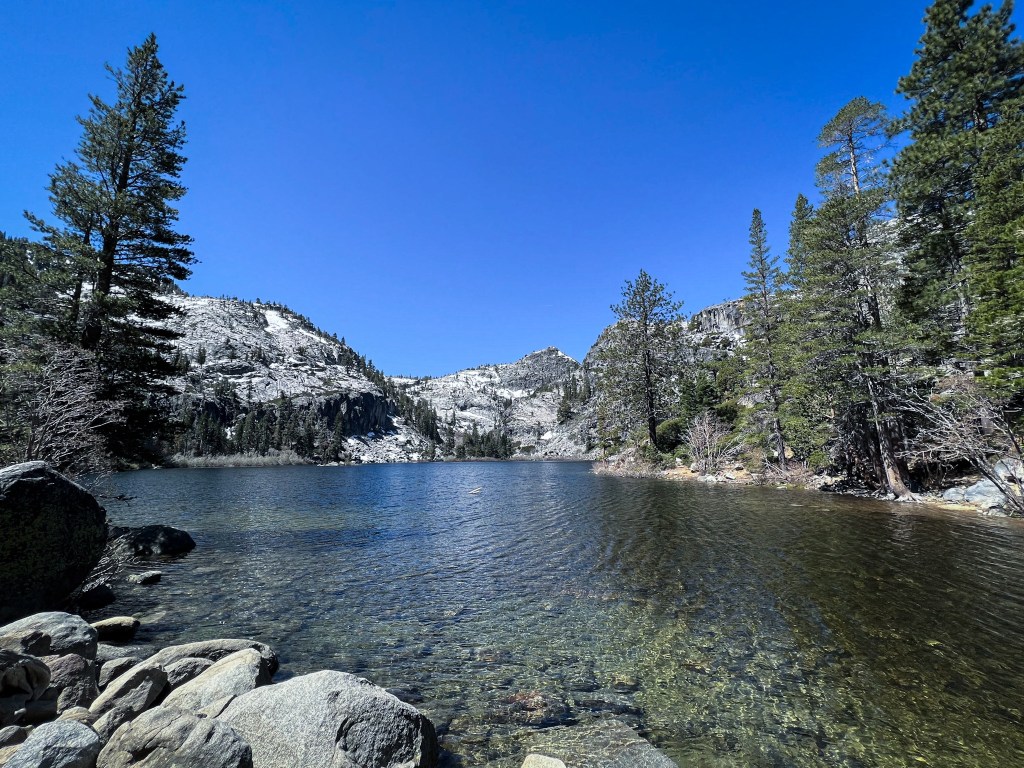
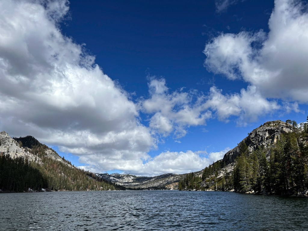
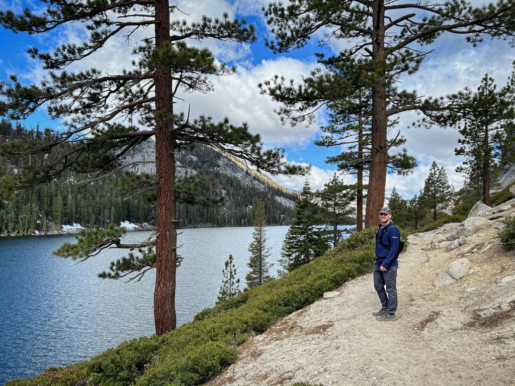
We were supposed to do clear water kayaking the following day but unfortunately for us, the wind was very strong and the water was too choppy so they had to cancel our tour. We decided to do the hike our new friends from the brewery had mentioned to us. We drove out to Echo Lake to do the five mile or so hike. It was cold out – probably high 30s, low 40s but it warmed up while we were out on the trail. I loved this hike. After about 6-7 days of straight hiking, it wasn’t too grueling and had beautiful views. The colors were unreal. I fell in love with alpine lakes during this trip. I couldn’t get over the color of the water. it was also crazy because the day we did this hike was May 30th and there was still a lot of snow around.
After the hike we went to another brewery for lunch and headed to a laundromat to wash the majority of our disgusting hiking clothes from the trip so far – the less glamorous side of road trip/hiking vacations! Later on, we paid for beach passes from our hotel so we could go down to the lake to watch sunset. We only lasted about 40 minutes, the wind was still really strong and we were freezing sitting by the water.
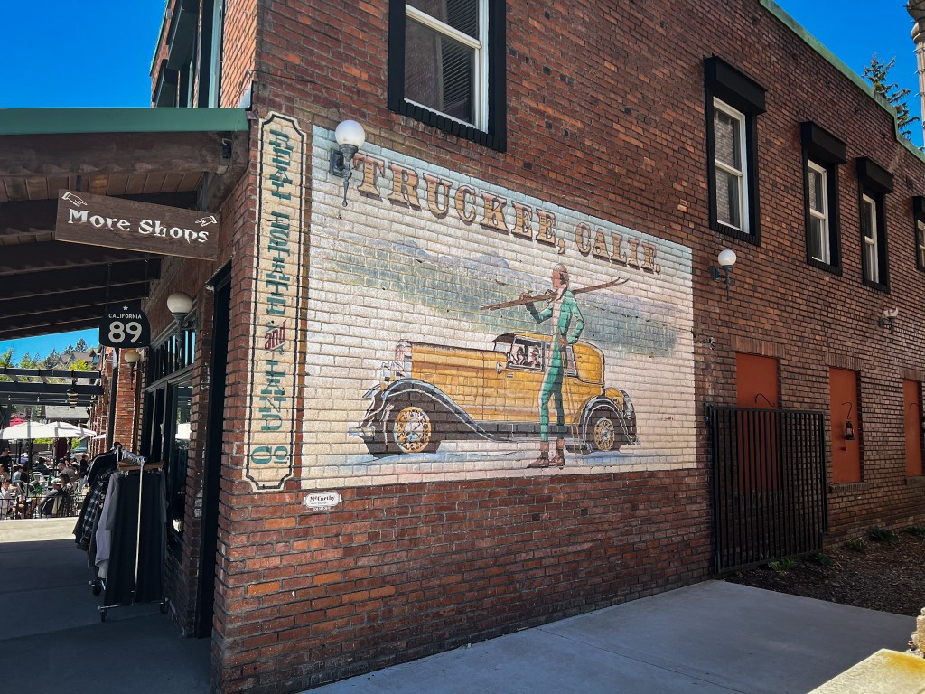
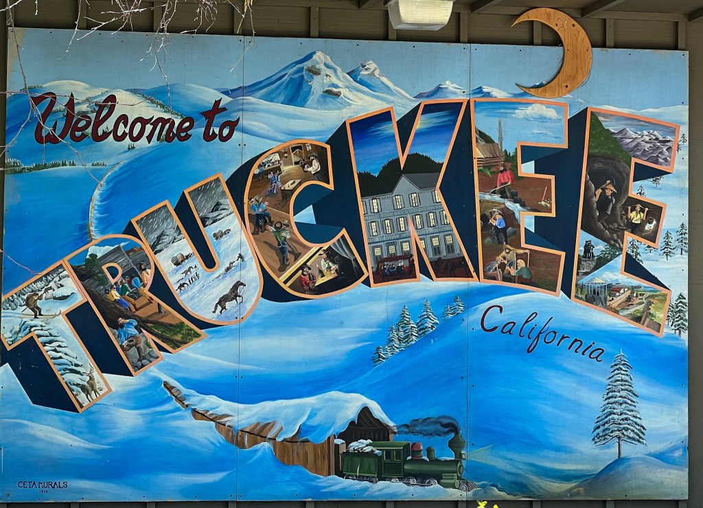
The next morning we grabbed bagels at a local shop and then headed North along the lake towards Truckee. Our first stop was 5050 Brewing – we had some great beers, great food and got to play with an adorable lab puppy that someone had on the patio. We were able to check into our hotel there early, which was good because Jarrett wasn’t feeling well. We thought from a combination of maybe the altitude, allergies and just general exhaustion so we decided to take it easy. We went into downtown Truckee and did a little shopping. Jarrett wanted a nap after that so we went back to the hotel and only popped out again later for dinner but overall it was a low key day. Truckee was a cute town though and I enjoyed our time there.
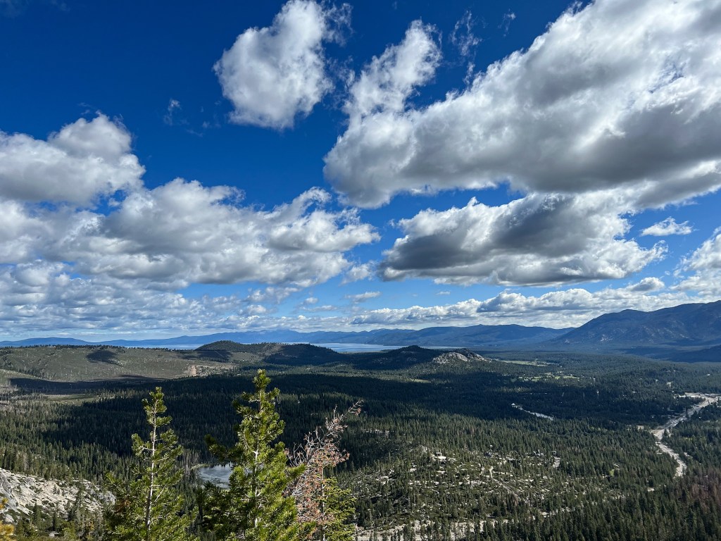
Wednesday morning Jarrett was feeling better so we got back out on the trail. We had planned to hike to Donner Peak but the snow foiled our plans. We got onto the trailhead only to find out most of the trail was covered in snow. We were able to continue along but it was a little questionable. We didn’t have poles with us so we shuffled along as safely as we could.
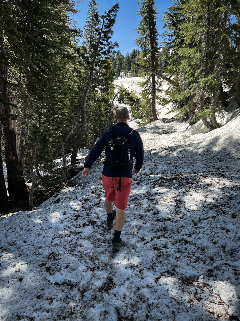
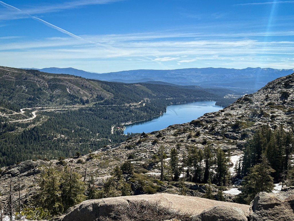
Further along the trail was clear, but occasionally we’d run into some snowy parts. We didn’t see too many other people out but at one point we ran into some older gentlemen who said they’d only been able to reach the summit with microspikes. Jarrett and I decided to go as far as we could and then we’d turn back. We got to a section where the snow was really thick and didn’t seem to let up, somewhat close to the summit, so we turned around there. We were able to find a false summit not far from the top where we sat for snacks and had a good view of Donner Lake.
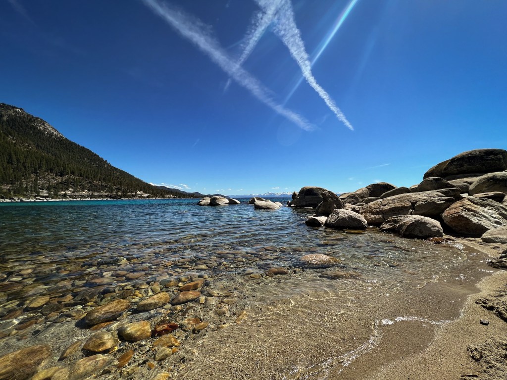
We were a little disappointed that we hadn’t been able to enjoy more of Lake Tahoe in the previous days so we decided we check out the north side of the lake in Nevada and try to find a free beach. We were in luck! We had to park about a mile away but we walked the bike path there, which was so nice. The weather at this point had changed again and it was very hot with no wind. When we got to the lake there were some people sunbathing and swimming. I’m so glad we went here because we really got to see how clear the water was and the colors!
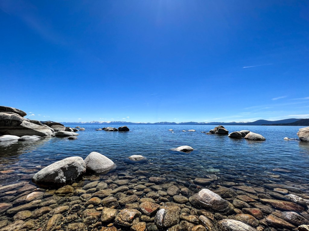
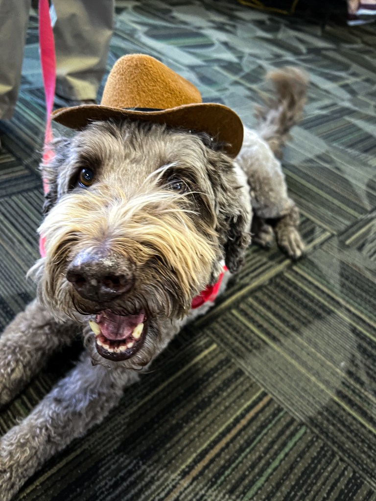
We hung out for a bit with our feet in the frigid water and sat in the sand just relaxing. It was beautiful. If I lived in the area, I’d probably go there all the time. Our flight was set to leave from Reno early the next morning, around 6:30-7 am so we wanted to go to bed early. Right before we shut off the lights for bed, we got a text message from the airline saying that our connecting flight to Boston had been cancelled. So I spent the next few hours trying to figure out how we were going to get home. We had to return the rental car early so we ended up just getting to the Reno airport early, finding some seats and sitting around for about 5-6 hours. HOWEVER, the best surprise happened. The Reno-Tahoe airport had therapy dogs that just walked around the airport for people to pet. They’re part of a program called Paws 4 Passengers. I got to play with five dogs while we waited – it was the best. I wish more airports did this!
Have you ever been to any of the places I mentioned here? If not, I hope they’re now on your list of future places to visit!
📍I acknowledge the lands mentioned in this post are the ancestral lands of the Nyyhmy (Western Mono/Monache), Me-Wuk (Southern Sierra Miwok), Nüümü (Northern Paiute), Miwok, Kootzaduka’a, Washoe, Cayuse, Umatilla, Walla Walla and Nisenan people.

Leave a comment