
This post contains affiliate links
The Mt. Morgan and Mt. Percival loop is a fun trail near Holderness, New Hampshire. It’s rated hard on AllTrails and is about five miles long. I would consider this more moderate but if you are unfamiliar with rock scrambling, or have a fear of heights or tight spaces, then you may feel differently.

The first time I did the hike was a Saturday in mid-May with some girlfriends. We parked at the trailhead, got out of the car, and immediately were swarmed by bugs. Hiking in the spring in New England is rough due to all the bugs. It was a challenging hike that day because we couldn’t stop to catch our breath without being swarmed.
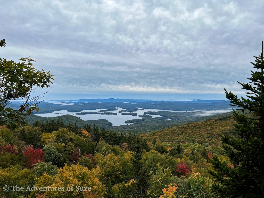
Fast forward to October when I did this hike again. While the trailhead was much more crowded than the first time, we had no issues with bugs which made the whole trek much more enjoyable.
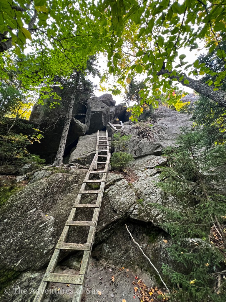
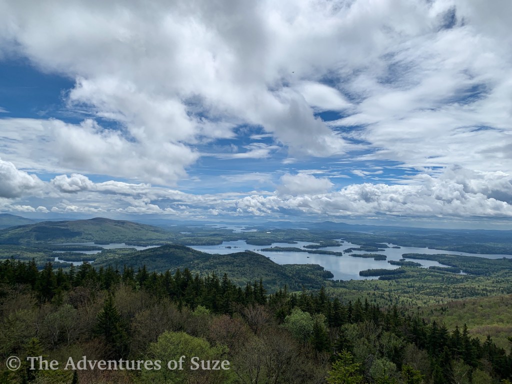
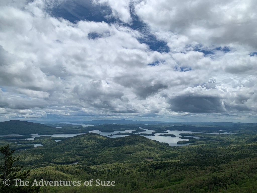
We started by going up the Mt. Morgan trail. Before you reach the summit, the trail forks, and you can either continue up the regular trail or take a set of three ladders and a cave to the cliffs route. Of course, we wanted to do the ladders – that’s the best part! However, if you are scared of heights, beware – the ladders are old and require some flexibility to maneuver and once you get through the cave, you have to do a little bit of rock scrambling. At the summit, the views were beautiful. From here you continue on to Mt. Percival. The trail between the peaks is fun – it’s relatively flat but has some scrambling to keep things interesting.

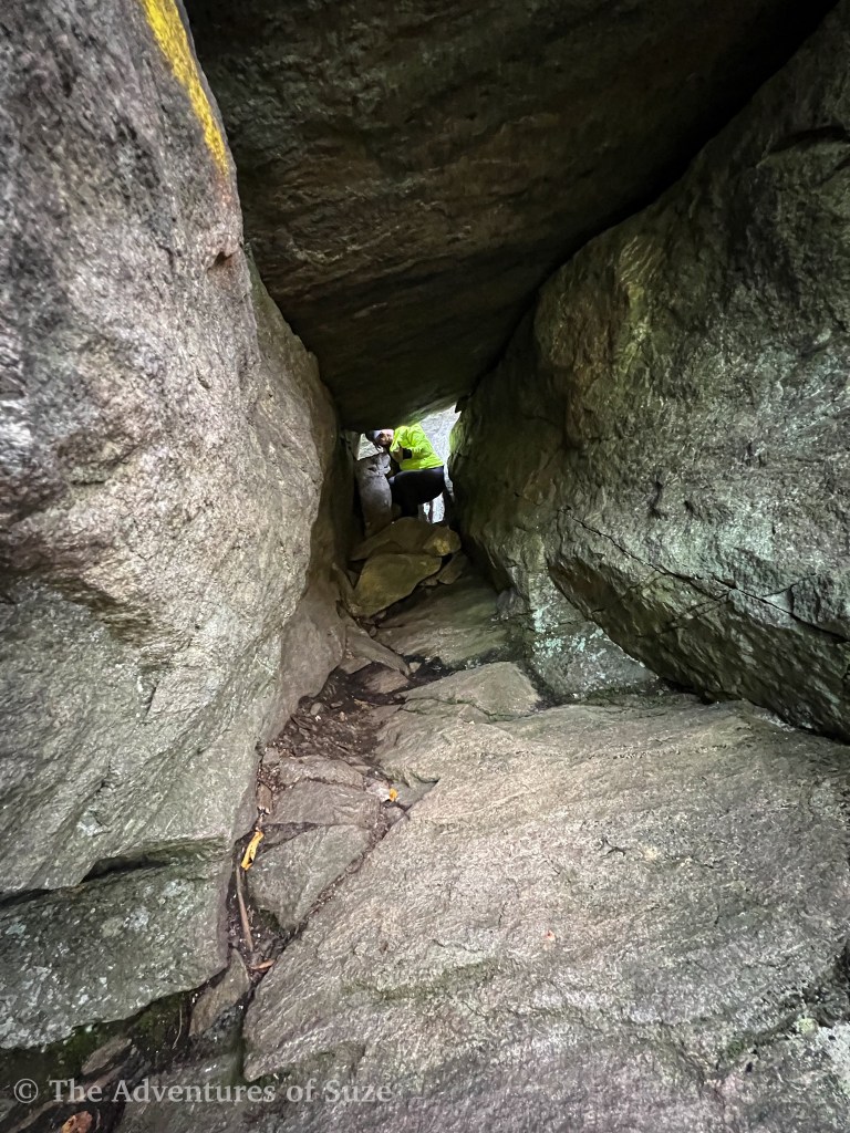
Similar to Morgan, two trails are leading from the summit of Percival. One route goes along the cliffs, which is pretty easy and uncomplicated. This is what I did in May because we wanted to finish the hike as quickly as possible due to the bugs. The second takes you down a more exposed route that funnels you through a series of caves. When I did the hike in October, I decided to try out the caves. It was so fun but a little wild. If you are afraid of small, tight places, then this trail is not for you. I got a little concerned in some places that I wouldn’t fit but I made it! We had to take our packs off at times since we couldn’t fit wearing them.


🥾 Approximately 5.5 miles round trip
⛰️ Approximate elevation gain of 1,522 feet
🌲 Moderate to hard, depending on fitness level
💰 Free!
🦮 Dogs allowed, but I would skip the caves if you bring your dog
🚽 No facilities at the trailhead, but if you cross the street to the Rattlesnake trailhead, there is a porta-potty there.

The descent was uneventful but pleasant. It took us about three hours to complete. I loved the hike and would suggest it for others looking for a fun adventure – just remember to bring bug spray and a bug net for your face!
Have you done this hike before? Let me know in the comments below!
📍I acknowledge the lands mentioned in this post are the ancestral lands of the Wabanaki (Dawnland Confederacy) and N’dakina (Abenaki / Abénaquis) people.

Leave a comment